Mapping the ground for the
infrastructure of tomorrow.
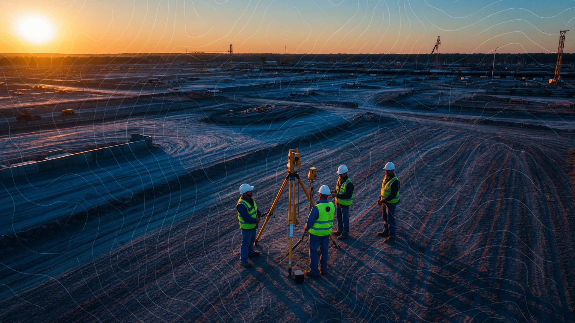
Reid Infra Company Limited is a specialist geospatial survey firm delivering high-accuracy topographic, hydrographic, geotechnical and aerial mapping data to engineers, developers and government agencies.
A full spectrum of geospatial and engineering survey services.
Topographic Survey
Land boundary, corridor and engineering surveys.
Hydrographic Survey
Bathymetric mapping, riverbed and coastal profiles.
UAV / LIDAR Mapping
High-resolution photogrammetry and DEM generation.
Geotechnical Investigation
Soil boring, SPT and rock coring services.
Utility Detection
GPR and electromagnetic underground utility mapping.
GIS & Data
GIS database, digitization and spatial analysis.
Industry-grade instruments. Engineering-grade results.
From multi-frequency RTK GNSS rovers and robotic total stations to LIDAR-capable UAVs and dual-frequency echo sounders — we invest in proven equipment to guarantee data integrity on every project.
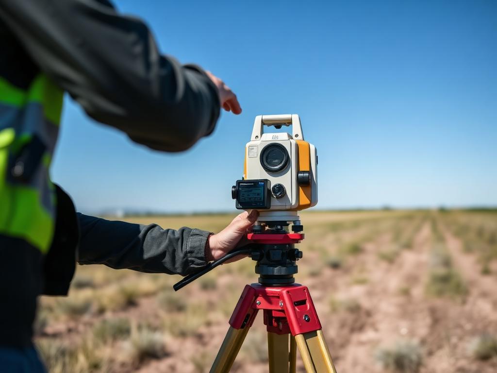
RTK GNSS & Total Stations
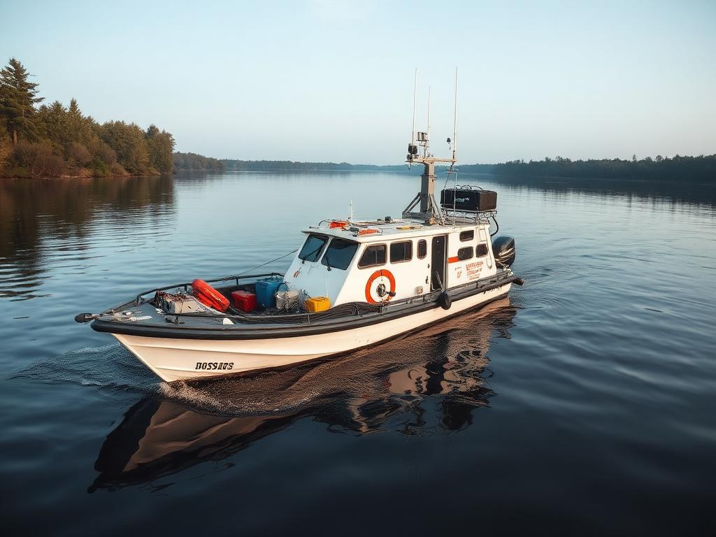
Multi-beam Echo Sounders

LIDAR & Photogrammetry UAVs
Engineered for accuracy. Built for trust.
Every deliverable is checked against rigorous quality controls. Our crews work within strict HSE standards and adhere to international survey accuracy classes.
HSE-Compliant Crews
Trained, equipped and insured field teams.
Quality Assurance
Multi-stage QA/QC on every dataset before delivery.
On-Time Delivery
Predictable schedules with transparent reporting.
Got a project? Let's map it together.
Tell us the site, the scope, and the timeline — we'll come back with a clear plan.